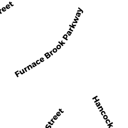
310 FURNACEBROOK PKWY
Owner Information
CHRONIAK ROBERT
310 FURNACE BROOK PKWY
QUINCY, MA 02169


Property Details
310 FURNACEBROOK PKWY is classified as a Single Family Residential (Ranch).
The primary structure on this property was built in 1950. There are 1,893ft2 of built area within this property. There is 912ft2 of residential/living space within this property. This property is listed as having 8 rooms.
310 FURNACEBROOK PKWY is valued at $313,200. The land is valued at $174,900 and the structures are valued at $133,900. There is an additional valuation of $4,400 on this property.
This property is in Zone RES B. Confirm with local Zoning Board authorities to ensure there are no overlays or other easements on this property.
The most recent deed for 310 FURNACEBROOK PKWY is recorded at the local registrar in Book 36594, Page 329. 310 FURNACEBROOK PKWY was last sold on Monday, February 4, 2019 for $0.
Assessment data from fiscal year 2020.
Flood Data
This property is completely within the AE Zone (within floodplain).
The base flood elevation for this flood zone is 11 feet.
This information is sourced from the FEMA National Flood Hazard Layer. See our full disclamer.
Broadband Internet Providers
| Provider | Type | Bandwidth (mbps) | |
|---|---|---|---|
| Viasat Inc | Satellite | 100 | 3 |
| Comcast | Cable | 1000 | 35 |
| HughesNet | Satellite | 25 | 3 |
| Starry, Inc. | Fixed Wireless | 200 | 200 |
| Verizon New England Inc. | DSL | 15 | 1 |
| GCI Communication Corp. | Satellite | 0 | 0 |
| VSAT Systems, LLC. | Satellite | 2 | 1 |
Broadband service provider data from December 2020.
Adjacent Properties
- 306 FURNACEBROOK PKWY
Single Family Residential owned by STANGEL JUNE H TREES - 7-9 PUTNAM ST
Two-Family Residential owned by NIGL THOMAS J - 4 HUDSON ST
Apartments with Four to Eight Units owned by OMALLEY VINCENT A - 2 HUDSON ST
Other, Open Space owned by MATTHEWS DAVID S - 2 HUDSON ST #B
Condo owned by MEADE LINDA J - 2 HUDSON ST #A
Condo owned by YU MELISSA G